3D LASER SCANNING FOR CONSTRUCTION & INDUSTRIAL FACILITIES

Professional 3D Laser Scanning Services for Construction & Industrial Projects

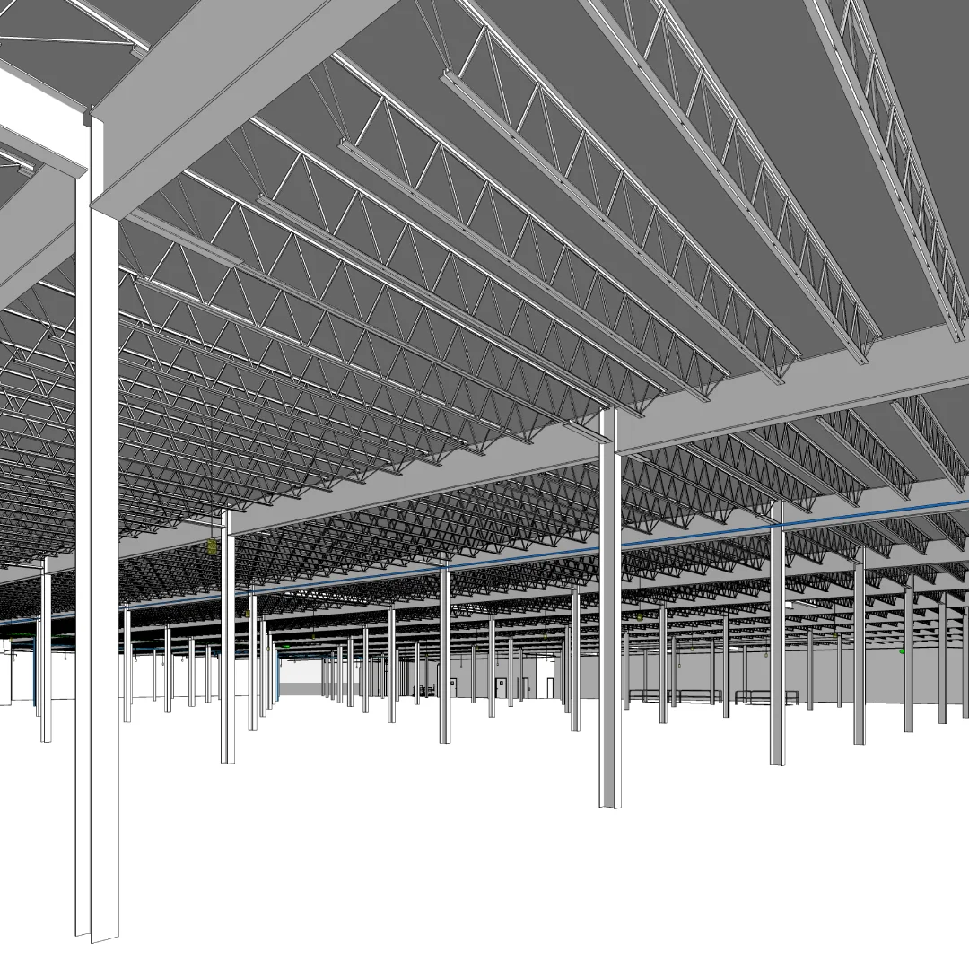
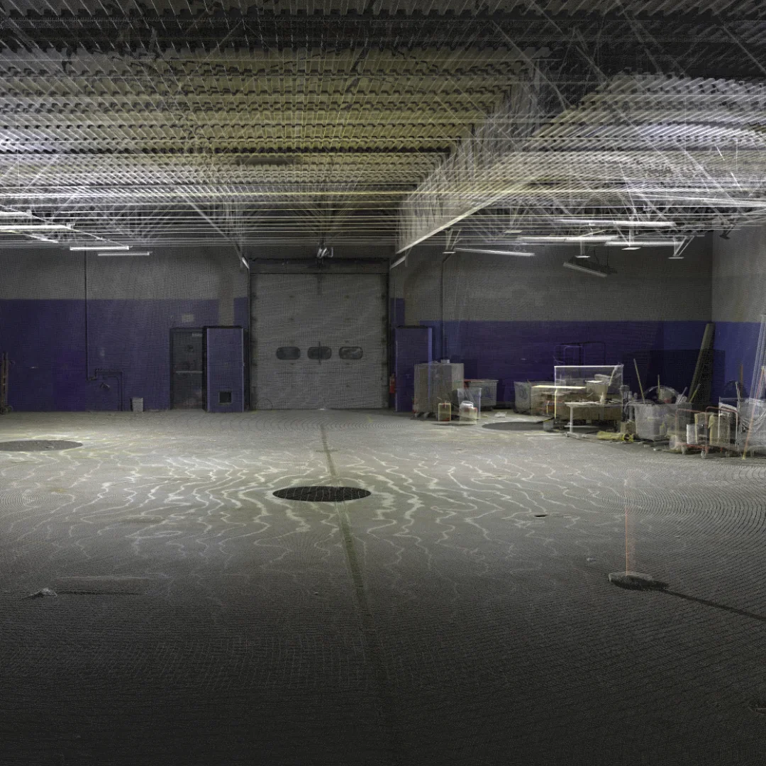
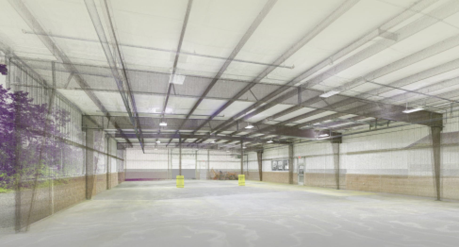
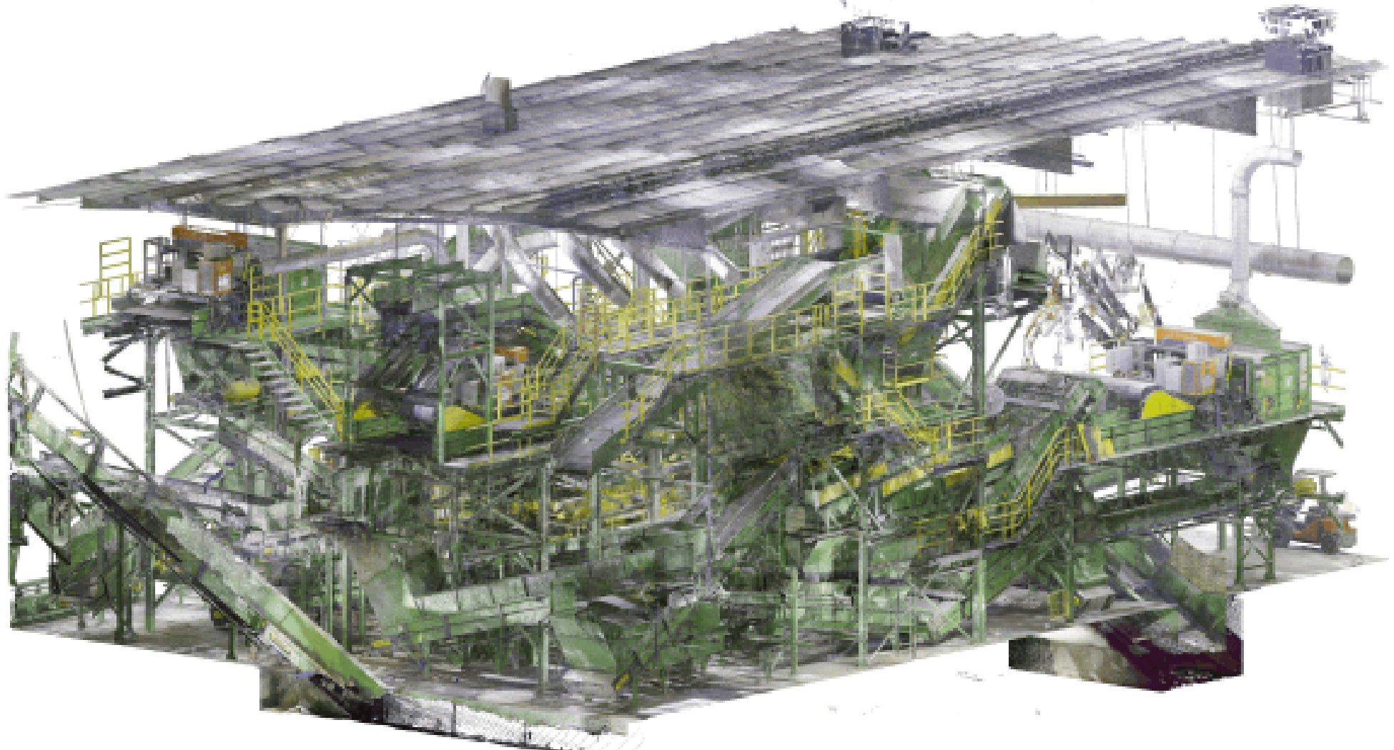
Capture as-built conditions using Leica RTC360 and BLK360 scanners. Replace tape-measure errors and repeat site visits with verified point cloud data delivered as CAD drawings, Revit BIM models, or raw point clouds, ready for your design and coordination workflows.

Request a Free Quote

Serving New England · Based in Portsmouth, NH · Licensed Construction Surveyors

Trusted by

3D Laser Scanning Built for Construction Decisions

OAR Scanning delivers professional 3D laser scanning for construction teams, industrial facility operators, and design firms. Our terrestrial laser scanning and LiDAR workflows capture millions of measurement points in minutes, giving you verified existing conditions data without the errors and rework that come from manual surveys and outdated drawings.

Planning Without Verified Field Data Costs Money

Common problems we see on construction and industrial projects:

How OAR's 3D Laser Scanning Solves These Problems

Complete 3D Laser Scanning Services

3D Laser Scanning for Construction

Scan construction sites, industrial facilities, and commercial buildings with terrestrial laser scanning and aerial LiDAR. Fast mobilization and accurate deliverables nationwide.

As-Built Documentation Services

Create accurate as-built drawings and as-built BIM models for renovation, retrofit, and facility management projects. Laser scanning captures reality so your as-built documentation reflects actual conditions.

Point Cloud to Model Conversion

Transform laser scan point clouds into actionable data. Point cloud processing, registration, and conversion to CAD, BIM, or digital twin formats

Construction Surveying Solutions

Licensed construction surveyors using 3D laser scanning for site surveys, layout, and as-built verification. Reduce field time while improving accuracy.

Real Results from OAR
3D Laser Scanning Services

Industrial MRF Retrofit Project

Scanned 110,000 SF facility to create accurate as-built BIM models for equipment planning. Early-phase scanning enabled design team to eliminate conflicts before fabrication.

Result: Client avoided costly field rework by scanning before finalizing design contracts.

Food Processing Plant Expansion

Delivered complete as-built documentation including point clouds, CAD drawings, and Revit models for facility expansion planning.

Result: Reduced site visits by 50% and accelerated project timeline with remote collaboration using scan data.

What Our Clients Say

Frequently Asked Questions

Our LEICA scanners deliver sub-millimeter accuracy on individual measurements and millimeter-level accuracy on registered scans across an entire facility – significantly more precise than tape-and-tripod surveys, and far faster.

Most projects are scanned in 1-3 days. A 50,000 sq ft industrial facility typically takes a single day with a two-person crew. We work around active operations – no shutdowns required.

Point clouds (E57, RCP, LAS, PTS), 2D CAD drawings (DWG/DXF), 3D Revit BIM models (LOD 200, 300, or 400), and web-hosted point cloud viewers. Tell us your workflow and we’ll match it.

Yes. Our scanners are portable and quiet. We routinely scan operating manufacturing plants, distribution centers, and occupied buildings without disrupting work.

Pricing scales with facility size, complexity, and deliverable type. Typical projects range from $3,000 to $25,000+. Request a quote and we’ll give you a price within 24 hours.

We’re based in Portsmouth, NH and primarily serve New England. For larger or specialized projects outside the region, we can travel – let’s talk about your project.

Why Construction & Industrial Teams Choose OAR for 3D Laser Scanning

Verified data, fast turnaround, and deliverables your team can actually use.

Want us to reach out?

3D Laser Scanning Services

in New England

© 2026 OAR Scanning LLC